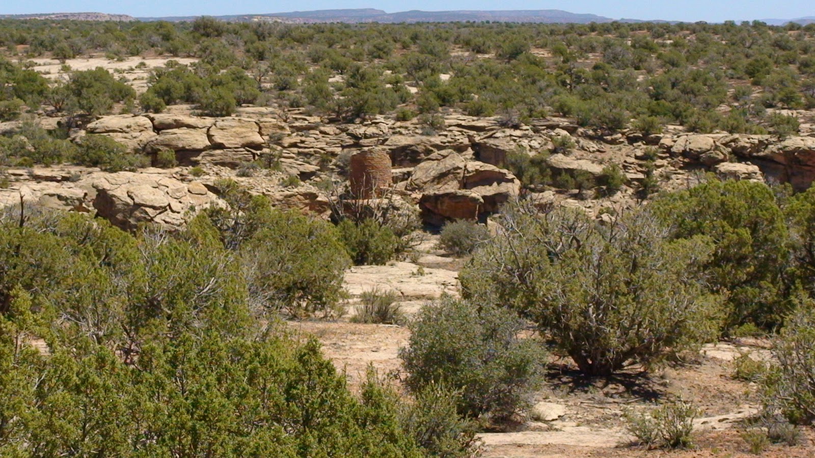
Edge of the Cedars State Park (Utah)

The Edge of the Cedars has a pueblo settlement where Ancient Puebloans lived from 750 and 1300 AD.  It also has a museum with an extensive collection of artifacts and a huge database of petroglyphs and rock art.

If you saw this uneven ground, would you know there was an ancient pueblo village buried underneath it?  Maybe not until you started digging for some reason.

It has a kiva that you can climb down a ladder and go inside.

Inside felt very cool and cozy.  I could see how it was a sacred space being in the earth like that.

Like most settlements, the pueblo was built on a high point with an excellent vantage point.

Inside the museum are some very unusual artifacts such as this sash made from macaw feathers dated 1150 AD.  It was found in Canyonlands.  Macaws were brought to the area by traders from Mexico.  The feathers were strung together with yucca cord.

This is an animal effigy that was found by James Murray near Cedar Mesa.

This is what he saw when he first came upon it.

This is a necklace made from insect legs.

The walls of the museum are covered with reproductions of petroglyphs and rock art that exist in the four corners area.

There is a wealth of information here at Edge of the Cedars State Park in Blanding, Utah. Admission is $5 per person and they are open Monday through Saturday.

Steel and Plaster Sculpture by Joe Pachak

Monument Valley

And so we entered the Navajo Reservation on UT 163 and came closer to the towering monoliths.

We weren’t sure whether this park was part of the NPS system or whether it was private.

We soon discovered that it is a tribal park, owned by the Navajo.  National Parks and Golden Age passes cannot be used.  Fee for entry is $5 per person with children under 9 yrs of age, free.  There is a visitors center, museum, hotel and a restaurant.  The park is open year round.

The park road is a 17 mile bumpy dirt road with a steep incline back up to the visitor’s center.  We needed our 4wd.  We did see visitors use cars/trucks/jeeps of various types, but the Navajo run tours for those who do not wish to drive… and they sure looked like they were having fun.

 The map was great and extremely helpful.

There are Navajo houses called Hogans.  They are made with natural materials and are still used today by Navajo elders for ceremonial purposes.  This is a female Hogan, mainly because of its shape.

This is a male Hogan.  Mainly because of its cone shape.  It can be erected and torn down quickly, so it can be used for temporary shelter.

And this is the inside of the Hogan.

Just have to say, we found this park experience absolutely incredible.

Now for some Monument Valley pictures…

East an West Mittens
Three Sisters
Elephant Butte
Balancing Rock

The Road to Monument Valley Through Valley of the Gods

From our campsite in Blanding UT, we headed south on 191 to 163W toward Mexican Hat. 

This took us through a red sandstone viewscape called Valley of the Gods.

Considered a smaller version of Monument Valley, it has been the location for several television shows.

You can drive through Valley of the Gods on a 17 mile dirt road, FR242.  It didn’t look too to us as we drove by, but I hear that a vehicle with high clearance is highly recommended. 

We thought the name was immensely appropriate.

Some of the rock formations looked like ancient temples.

As we passed the incredibly scenic area…

…we saw the Mexican Hat rock, for which the town is named.

 It seemed that breathtaking beauty could be found everywhere we looked.

And then we saw the first clue to Monument Valley.

And we braced ourselves for an incredible experience.

Natural Bridges National Monument

From our campsite at Blue Mountain RV Park, we headed south on 191 and then west on 95 to Natural Bridges National Monument.

This was the first National Park area in Utah.  It was discovered in 1883 by a man named Cass Hite.  he had a mining claim on the Colorado River and wandered into Stone Canyon and discovered three monolithic bridges.  To this day, nowhere else in the world are there so many bridges in the same area.

Millions of years after the lifting of the Colorado Plateau, glacial melt from the end of the last ice age and abundant rains brought massive flooding that provided the power to carve the canyons in the southwest.

As the rushing waters meandered through the canyon, water worked against the banks of the bends in a way that broke through, cutting off the bend and creating a shortcut that is a bridge.

This is Sipapu, the first of the three bridges in the park.  Sipapu means “the place of emergence” in Hopi language.

Sipapu, close up.  It is 220′ high and 268′ wide.

And this is Sipapu from a different angle.  There is a 9 mile park road that takes you to different vantage points throughout the park.  There are also walking trails that take you under the bridges.

Kachina is the second bridge.

Kachina is 210′ high and 204′ wide.

The third is Owachomo, which is Hopi for “rock mound”.  It is 106′ high and 180′ wide.

Bridges differ from arches.  Bridges are formed from water and arches by wind and sand. 

Natural Bridges National Monument has an Ancestral Puebloan settlement named Horsecollar Ruin.  It was inhabited between 1050 and 1300 AD. 

To the right is a double chambered storage area or granarie.  The doors are horse collar shaped, thus the name.  There is a square kiva in the center, which is associated with the Kayenta area of northern Arizona.

Although not visible (covered with earth), there is a round kiva here.  Round kivas are associated with the Mesa Verde area.

 In order to see this site, you have to walk a .3 mile trail.

 The trail is well maintained but can be tricky for those who may become unsteady on their feet.

We had a fun day.  Here are a few pictures of the park.

Mule Canyon Ruin State Park (Utah)

Just want to say that the Utah State Park sites are really well done and no disappointment.  We saw several groups here geocaching and having a great time.  This site in Mule Canyon is interesting because it had a keyhole shaped kiva, underground tunnels and  a subterranean pithouse.

The keyhole shape was made so by the addition of a rectangular antechamber, facing south.

 This L shaped pueblo had 12 rooms.  It was used by two or three family groups. 

This is the tower.  It was probably two stories high.  It may have been used for defense, for skywatching, for signaling to nearby Seven Towers settlement, or for defense.

This settlement was built in 750 AD, but its main occupation was between 1000 tp 1150 AD.  This is the way it would have looked at the time of the Ancestral Puebloans’ life here.

What is really neat about this complex is that there are two underground tunnels.  One connecting the house to the kiva and the second from the kiva to the tower.  This allowed the residents here to get around by crawling underground.  The use of underground tunnels is uncommon to this area.

Hovenweep National Monument- Holly Group

To get to the Holly group, we entered Canyons of the Ancients National Monument.

Even reading the map at the kiosk, it was hard to figure out what was what.  I could only assume there was an overlap.

We took a bumpy dirt road.  We began to wonder if we were lost.

 But then Angie spotted something out the window.

So we knew we were close.

Then a sign confirmed we were on the right track.

It was a really a great trail out to and along the rim of Keeley Canyon.  Probably .3 mile long, not far at all.  The views as you came around a bend and the structures appeared out of the landscape was just an amazing experience of discovery and awe.

This house actually split in half as the ground beneath the boulder washed away and the boulder shifted, spilling much of the walls and the upper levels into the canyon.  It is aptly named Tilted Tower. 

Look at this amazing tower.  Look how it is built so perfectly into the boulder upon which it rests.  It stands beside a spring and was built from the inside.  Handholds were pecked into the boulder base for access and entry.  It is called Boulder House.

The group is named for James Holley who was a rancher in the area in the late 1800’s.

The way these structures were positioned near water showed how important water was to them, providing life for their crops and for themselves.  They were protecting it and praying for it to continue to flow.

But it didn’t flow.  During a 23 year regional drought, the occupants of this canyon left around 1300 AD.  These buildings have weathered for seven centuries here in the high desert.

Then the trail became Petroglyph Trail and it ended on a boulder.  We looked and looked until we spotted a sign.

Staining made many of these rock art symbols hard to detect, but we could tell there was more there than our eyes could see.

One of our friends told us that these symbols were supposed to tell who they were, what they were doing, and why they left.

Petroglyphs were carefully pecked and scratched into the rock using stone tools.  They used a hard hammerstone or a pecking stone and sometimes antler in a hammer and chisel method. 

One cannot help to wonder what they were trying to tell us.

So we took the trail back.  It was a little uneven and rocky but so worth it.

What’s amazing is that even after centuries, we come to view the remainder of their labors and connect with the essence of who they were… and after so long, we can.

Hovenweep National Monument- Little Ruin Canyon

We’re in Blanding, Utah at one our favorite stops, Blue Mountain RV Park.  Duke and Rose in the office that is also the Trading Post are quite the pair and are fun to deal with.  Gary is great and takes care of the park and also gives tours of all the wonderful things to see in the four corners area.  They have some beautiful Dinosaur Bone, Coprolite and Turquoise for sale as well as some incredible Native American jewelry.

While here, we went to see Hovenweep National Monument.  Anyone visiting the National Parks needs to know that our country’s National Monuments are nothing to sneeze at.  While not a full scale National Park, they are still well worth seeing.

Hovenweep consists of six clusters of Pueblo buildings scattered around the canyons of the Cajon Mesa of the Great Sage Plain.  The settlements are: Square Tower, Holly, Hackberry, Horseshoe, Cutthroat Castle, and Cajon.  Most settlements are based around ancient springs that they dammed to control the water.  Some of these settlements are in the Canyons of the Ancients National Monument territory.  We went to two of the Hovenweep sites.  It was a little confusing to find the second site.  Signage was spotty and the only thing we had to go by was verbal directions from the Ranger at the Visitor Center.  Even with the navigational challenges, these sites are well worth seeing.

There is a campground there with no hookups that can accommodate rigs up to 35 feet long.

The trail runs along the rim and is 1.5 miles long.  It is a good trail but can be a little uneven.  As we approached the rim of Little Ruin Canyon, we saw the twin towers.

The buildings here were constructed between 1230 to 1275 AD, about the same time as Mesa Verde.  The inhabitants came here from Chaco Canyon.  These towers are among the most carefully constructed buildings in the southwest.  One is oval and the other is horseshoe shaped and there are sixteen rooms total.

This is Stronghold House because it looks like a fortress.  Entry was by way of climbing a series of toeholds chipped into the rock or by climbing a wooden ladder.

This is Boulder House, named so because the building was incorporated into the huge boulder.

I think this is my favorite because it reminds me of a gnome house.  😉

Angie wanted to go play in it.

This is Tower Point and it has a complete view all the way up and down the canyon.  Some of the rooms in the tower were used to store food from the crops they grew.

There were about 100 to 150 people at this settlement.

Some people wonder whether they built fortress like buildings for protection.  Researchers think that at first they weren’t.

For many years after they arrived, this community thrived on the flow of water from the spring with this check dam.

But soon a 23 year drought struck the four corners area and food became scarce.  Neighboring tribes may have been forced to seek out food from neighbors and not necessarily in a kind way.

The lack of ground level doors, massive walls, portholes and high vantage points as well as protected springs all support the theory that this community was built with defense in mind.

By 1350 AD the community was abandoned.  It is thought they migrated to the Hopi Mesas of Arizona and to the Rio Grande Puebloan area of New Mexico.

Next we’ll see the Holly House site.

Three States Around Four Corners

We left Kirtland NM and headed west past Ship Rock.

We said goodbye to the northeast corner of New Mexico as we headed north.

And said hello to the Colorado mountains ahead as we soon turned west…

beautiful open scenery…

and huge picturesque buttes.

Then, we said hello to Utah.

And Utah was no slouch.

We passed through the town of Montezuma Creek where we saw some real greenery.

 And the sandstone formations appeared…

and got bigger…

and bigger…

and bigger still…

oh heck, this is Utah.  

After three beautiful states, we made it to Blanding UT where we plan to see Hovenweep and Natural Bridges National Monuments.

Salmon Ruins

On the way back to Kirtland from Chaco Canyon, we stopped to see Salmon Ruins.  It is a privately owned by the San Juan County Museum Association.  Admission costs $2 seniors and $3 adults.  It was built 1088 to 1100 CE (AD).  In the late 19th century, the property was homesteaded by George Salmon and his family.  The original homestead and outbuildings remain and are part of the self guided tour with a very nice walking trail.  Pets are allowed (on a leash of course).

The Chacoan Great House  has 150 first story rooms and 100 second story rooms.  It is very well preserved.  The guidebook on loan (give back or keep for $3) is very comprehensive, with excellent information including a room by room description of what it was used for and what was found in the room.  We found this information to add to our experience of Chaco Culture.

This settlement was abandoned around 1150 and was later re-occupied by the Mesa Verde peoples.

This one has a tower kiva.

 and one great kiva.

You gotta wonder what the Salmon family’s face looked like when they discovered what was on the property they were homsteading. 

Evidence shows that one of the rooms housed turkeys.  Turkey bone artifacts were found too.

Situated on the bank of the San Juan River, it was interesting to see rounded river rock incorporated into the structure.

There were two fires.  One in 1250 and one in 1270.  A woman and several children were killed in the first one when the wood holding up the kiva roof burned and caved in while they were standing on it.  The site was abandoned permanently after this date.

The museum contains many items from the site.  This gives special insight into what life was like here.  Here are some of the items in the museum.

Chaco Canyon Video and Author’s Note

Here’s the video. Enjoy!

 Author’s Note on Chaco Canyon:
When you visit these Ancient Puebloan sites, particularly those run by the NPS or State Parks, you will get a politically correct version of what is known about the site and the history.  I feel my presentation would be incomplete without mentioning the fact that there is evidence of a very politically incorrect aspect of these sites.  I am attaching a link to another blog that I feel gives the research in a comprehensive manner.

Warning:  This information may blow away anyone’s romanticized version of the Chacoan lifestyle.  Some of the information may be shocking.

http://gamblershouse.wordpress.com/2011/01/28/the-cannibalism-collection/