
Category: Rockhounding
The Road to Quartzsite

We excitedly embarked on the final leg of our journey to Quartzsite. We went through Phoenix…

…and saw palm trees…

After Phoenix, we saw cactus…

… and soon we came over the ridge, and saw this– the tiny desert town of Quartzsite. It was as if there was a luminescent halo over it. “OMG, it’s like Woodstock!” I exclaimed.

And it was.

We found a full hookup at Desert Gardens on a first-come-first-served, squatter’s rights rules and set up camp. Then, I packed a backpack with water and camera and headed on foot toward the rock show.

I was awed and amazed at the number of vendors and the variety of things- all rock related… and not.

I felt like a kid in a candy store.


Rockhound State Park

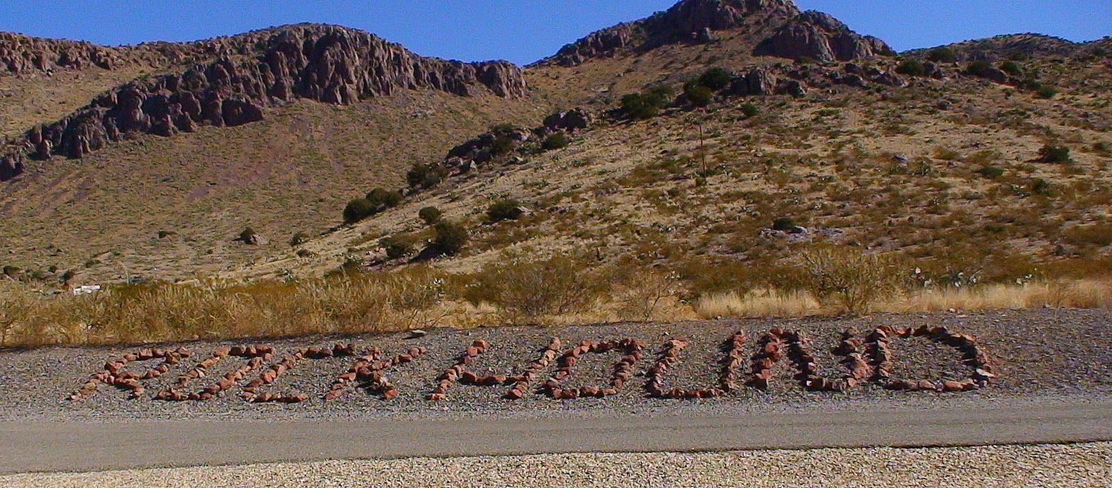
After Some shopping, we headed for the hills and New Mexico’s Rockhound State Park.

The only place we’ve visited where they encourage you to take rocks! You get up to 15 lbs. per person.

There are campsites there with W & E, but day use was a fee of $5 (unless you have an annual NM parks pass).

And Angie was allowed to come.

This is what can be found there. There is some pretty Jasper, Common Opal and Thunder Eggs.

We went for the pretty Varigated Jasper.

It has the colors of New Mexico in it.

And we did pretty well.

To get the T-Eggs, you have to climb that there hill and dig!
 |
| Sure enjoyed our day at Rockhound State Park! |
In the Heart of West Texas

Before we left Kerrville yesterday morning, Angie and I checked the gravel along the banks of the Guadalupe River for more finds. This is a Flint nodule with fossilized critters. Can you see all the little skeletons?

We said goodbye to Kerrville and its rocks and its river. The Guadalupe River runs from Kerrville County to the San Antonio Bay on the Gulf of Mexico. It has several dams and is listed as one of America’s top 100 trout streams.

The terrain was rocky and hilly with plenty of greenery. Then we began to notice the hills stretch.

Hills became mesas and we got to see their structure as the highway cut through them. Mesas are formed through the power of erosion. The harder and stronger rock is more resistant to water and protects the rock layers below.


It definitely looked like Texas.
 Then the view began to really open up…
 … becoming more dramatic

… and made us say WOW…

…and WOW again.

We passed a huge wind mill farm.

And oil rigs.

Then the Davis Mountains appeared…

…and we came to the town of Van Horn…

… with a hearty Tex-Mex feel…

…everywhere.

These guys were not our dinner. I now understand the difference between east and west Texas. It reminds me of South Dakota where there is a real delineation between the east and west influences of the edges of the state. East feels like east and west feels like west.

Angie was really happy that we finally made it to warmer weather. Nights still get chilly, but today was in the 70’s.
We decided to stay a few nights to soak up some warmth while we rest up a little, do some laundry and restock fuel and groceries.
We realized we were very near two national parks that we haven’t seen, so tomorrow we head for Guadalupe Mountains and Carlsbad Caverns National Parks.

On the Guadalupe River

Been a bit nippy here in Texas, but that’s supposed to change soon. Yesterday, we said goodbye to friends Don and Dorothy and continued west on I-10.

Our surroundings were rather flat and open with scrub bushes and small trees. We began to see ponds and lakes. Then the topography began to change, and the southwest appeared before our eyes.


A Rockhobbit and a Desertdweller

Visited my friends Jamie and Sheri at Jamie’s house. The first thing I got to see was the cool pond Jamie is building in her yard.

I didn’t get to take a real good picture of them, I was so happy and amazed at everything. But, here’s Sheri’s foot. She was out riding quads with Jamie in the desert and got a boo-boo. But, after a week, she is back on her quad again!

Got to learn so much in Jamie’s yard. She’s got them organized around trees. There’s all types of Arizona Agate, Jasper and Pet Wood imaginable. Fossils, crystals, specimens… you name it, Jamie’s got it!
Her website is: http://www.arizonalapidaryandminerals.com
Sheri’s website is: http://www.rockwrapsody.com/

She specializes in beautiful Chrysocolla, Shattuckite, Malachite, and Gem Silica.


She took me out for a ride on it.
If you ever wanted to know what it was like to ride with Jamie, here is video…
Dinosaur Bone Museum


There was even a comparison of a Mammoth tooth to a Mastodon tooth.

Beach Agate Collecting
 Since we hit the Pacific Coast, we’ve tried numerous spots to collect beach agates. Point Brown, Washington is a well-known spot, but alas, I was one of hundreds of agate hunters and had no luck. Then we tried Agate Beach on the central coast of Oregon. Since the construction of the jetty in Newport, beaches filled up with sand and Agate Beach is now a misnomer. We sadly retired to our campsite at Oregon South Beach State Park, accepting that the experience of spotting a beach agate may not be ours this trip. So, Angie and I set out to just enjoy some quality beach time. I did see a few rocks, but nothing as abundant as Point Brown. A few steps onto the beach I picked up the first one I saw and saw this.

I turned it over in my hand and saw this. I couldn’t believe my eyes! I finally found a beach agate, and a nice one at that! And… I wasn’t even at the water line, but in the dry sand! So, I walked up to the nearest fellow hunter I saw, a nice gentleman, and asked him if he was hunting agates and if he had any luck. He showed me a plastic baggie with seven agates that he had just found in the last 15 minutes. I silently said thanks for having such luck choosing this campground and Angie and I hunted and played ball.

I spotted this one in one of the tidal pools. It’s translucency made it very easy to overlook.

So I decided that tidal pools were a good place to look and soon got lucky again.

This one almost got away, but something told me to pick it up.

When I turned it over and held it up to the sunlight, it’s identity was clear.

There was this tiny little lacey one.

And this one which is dying to become a cabochon.

I was also delighted to see some Astoria Formation fossils. They were loosened from the sandstone cliffs up shore.

I named this one “Fossilized Penguin”.

And delighted in the variety of jaspery beach stones.
Today we headed inland, through beautiful mountain pines and pristine lakes. Tomorrow we visit Crater Lake National Park.
Rockhound’s Paradise on Washington’s North Bay

We moved to a new spot on Washington’s beautiful coast yesterday. It’s right on the North Bay shoreline and is owned and managed by the Quinault Indian Tribe. (Known as Point Brown in the Washington Gem Trails book) How wonderful it is to walk right out onto the beach from our camper. We can see Mt. Rainier way in the distance when it is clear.

And the Olympic Mountains with Mt. Olympus. There is a sandspit with driftwood and beach stones. Beach walking as the waves work the stones around in the sand is a delight.

The Nisqually Glacier, one of the largest glaciers on Mt. Rainier, once carved out this valley and deposited many rounded stones here. This makes for some rockhound fun! I found Petrified Wood, Red Jasper, Chinese Writing Stone (Porphyry), Granodiorite, Basalt, Dassasite, Breccia, Fossils in Limestone & Sandstone, Chert & Epidote. I did not find any agates, which are here (Carnelian type).

This is a super doggie-friendly place. Angie got to run off leash on the beach and got totally tuckered out. We also found a silver ring and a pocket knife metal detecting on the beach. Tonight’s sunset was the perfect ending to a perfect rockhounding day.
Tomorrow we cruise south to Oregon’s beautiful coast. Friends Herb and Dawn, our neighbors at the campground in Kalispell, spent a couple hours giving me invaluable tips for making our upcoming tour of Oregon and California fantastic. Huge thanks to Herb and Dawn for their kind help! You guys rock!
Olympic Peninsula: The Sea


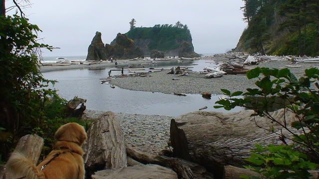
One of the most photographed places on the Olympic Peninsula is Ruby Beach.

Offshore islands like these are called “Stacks”. They are ghosts of former coastal headlands. Surf gnaws away softer rock, leaving harder rock to provide sanctuary for ocean birds to breed and raise their young.

Rocks like these line the coast. They are rounded because a glacier carried them down the mountains to the sea and further smoothed by nature’s tumbler… the sand and sea.

This sign warns of Tsunamis and educates visitors before reaching the beach on what to do in case tsunami waves should arrive.

Wave action can undercut cliffs and cause trees to fall down onto the beach where they are rounded by the sea as driftwood until a lucky visitor finds just the piece they were looking for and takes it home

All this quality beach time gave us an appetite.

So we headed for the Kalaloch Lodge and had some Kalaloch Clam Chowder with Olive and Rosemary Bread and Oyster Crackers– YUM!
You must be logged in to post a comment.